Monuments
Cartagena
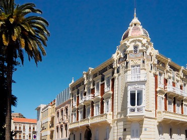
The façada has architectural influences of the Renaissance while maintaining a modernist air, typical of this type of architecture in the Levant.
Museums
Cartagena
THE REGIONAL MUSEUM OF MODERN ART is a place to contemplate and enjoy artistic manifestations from the XIX century till the mid XX century from the Region of Murcia and other areas. Located in the Aguirre Palace and in a modern adjoining building, the museum beholds modernism and traditions. In the exhibition halls of the museum, we can appreciate the artworks by some of the most important artits of th epoch, and allows the visitor to envisage and approach this period so crucial in the History of Art.



Monuments
Cartagena
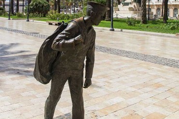
The sculpture of the conscript sailor intends to pay a small tribute to all those young people who, with their bags on their shoulders, arrived in Cartagena to perform military service. The statue, full body, is made in bronze and is located in the Héroes de Cavite and Santiago de Cuba square, next to the Town Hall. Its author is the Cartagena-born artist Jorge García Aznar. The sculpture is a young man dressed in the uniform of Navy Corps, carrying a bag on his back.

Holiday accommodation
Los Cuarteros (San Pedro del Pinatar)
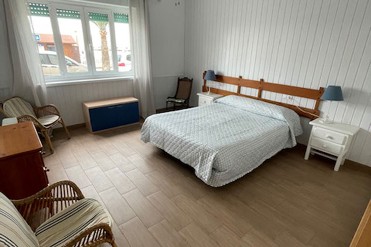
Apartamento en primera línea de playa sobre el paseo marítimo, preciosas vistas y en pleno centro, reformado y amplio.
Tiendas especializadas
Campos del Río
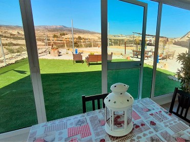
Recinto Rural con servicios para el peregrino y eventos varios. Lugar de recreo y descanso con aseos, comedor, recarga de moviles, posibilidad de encargar comida, etc. Lugar de recreo en un espacio rural y seguro para descansar en familia. Teléfonos: 628 800 621 686 356 133 Horario: A requerimiento.





Holiday accommodation
Atamaria (Cartagena)
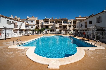
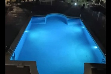
A villa holiday booked with Resort Sales and Management gives you the best of both worlds - all the freedom, privacy, and space offered with your own private accommodation, whilst being based on one of our resorts which offer a superb range of leisure activities and facilities. All bookings made directly with us include a welcome pack, all towels and linen (including pool towels), and our exclusive Resort Card which provides the holder with privileged discounts and offers from a wide range of shops, restaurants and bars on and around our resorts. It’s free to call us from the UK on 0800 634 9191 or from outside the UK on +34 968 175 570, so get in touch and one of our resort based team will be pleased to answer any questions you may have about booking your holiday with Resort Sales and Management. Check availability: www.costacalidaresorts.com Email: reservations@resortsalesandmanagement.com